Total Distance: 16.2 miles
Time: 6 hours 36 minutes
Points of Interest:
Whitchurch Bridge
St Mary the Virgin Church
Gatehampton Railway Bridge
The Goring Gap
Goring Lock
St Mary’s Church
Cleeve Lock
The Beetle and Wedge Pub
Moulsford Railway Bridge
Wallingford Castle
St. Leonard’s Church
Wallingford Bridge
Shillingford bridge
Arriving in Pangbourne at around 11:30, we made our way to the Pangbourne Café (formerly the Garden Cafe). I ordered coffee and got a stamp for my Walk the Thames passport. A group of women at a nearby table admired Cher, asking about her with smiles and that familiar small-town kindness that always encourages you to stay a little longer than planned.
There was a slight chill in the air, but the sun was shining, and the sky was clear, a perfect day for a walk. We sat on a park bench on the river’s edge, overlooking Whitchurch Bridge, which links Berkshire to Oxfordshire. The bridge is one of only two privately owned toll bridges across the Thames. The bridge is owned and maintained by The Company of Proprietors of Whitchurch Bridge, which was authorised by the Whitchurch Bridge Act 1792. The bridge has seen rebuilds in 1853 and 1902, with a major refurbishment completed in 2014.
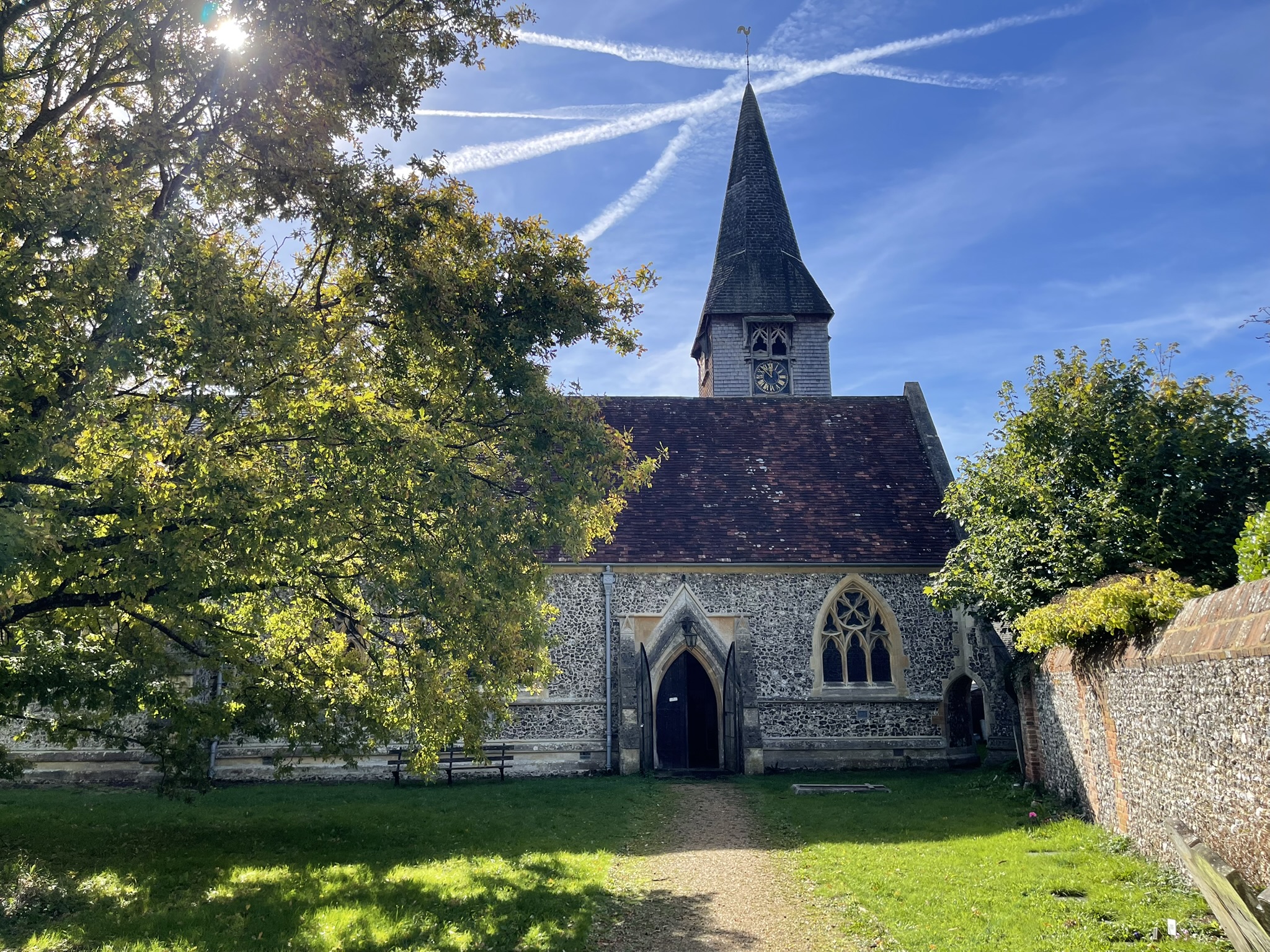
With the coffee drank, we got on our way and crossed Whitchurch Bridge, and passing through the grounds of St Mary the Virgin Church. This site has hosted a church since the 12th century, with the current Grade II listed building consecrated in 1885 following the disrepair of its predecessor.
The path then kinked away from the water, leading us uphill along the High Street. We continued along a bridleway, encountering a few horses. I picked Cher up in case she startled them. After some steep steps, we rejoined the river, though at a higher elevation than anticipated.
We descended slowly until we were level with the river, taking our first rest at the bottom. I shared a snack with Cher, who was already planning her first swim, but if she wanted to be carried, a dip in the water was out of the question.
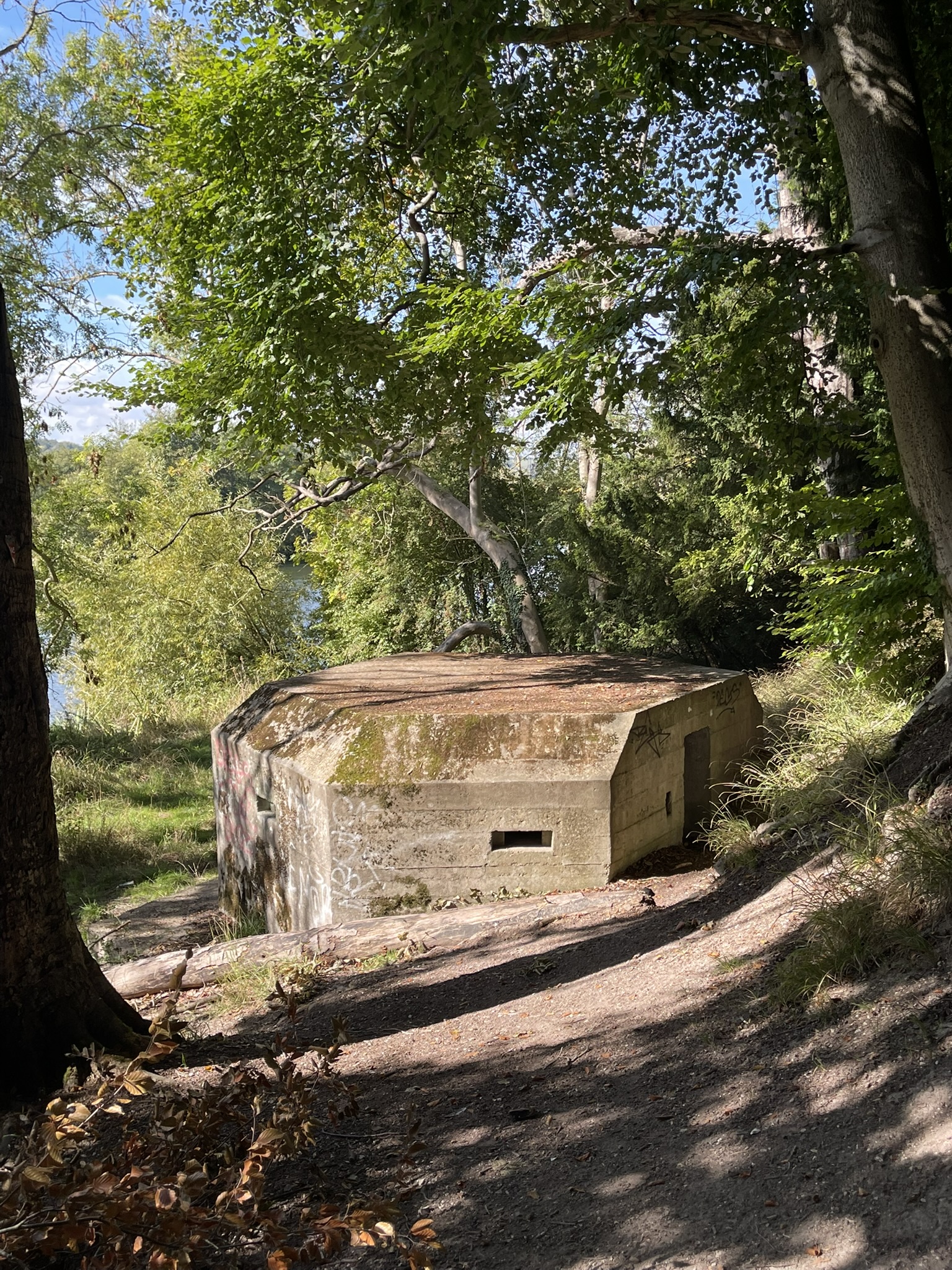
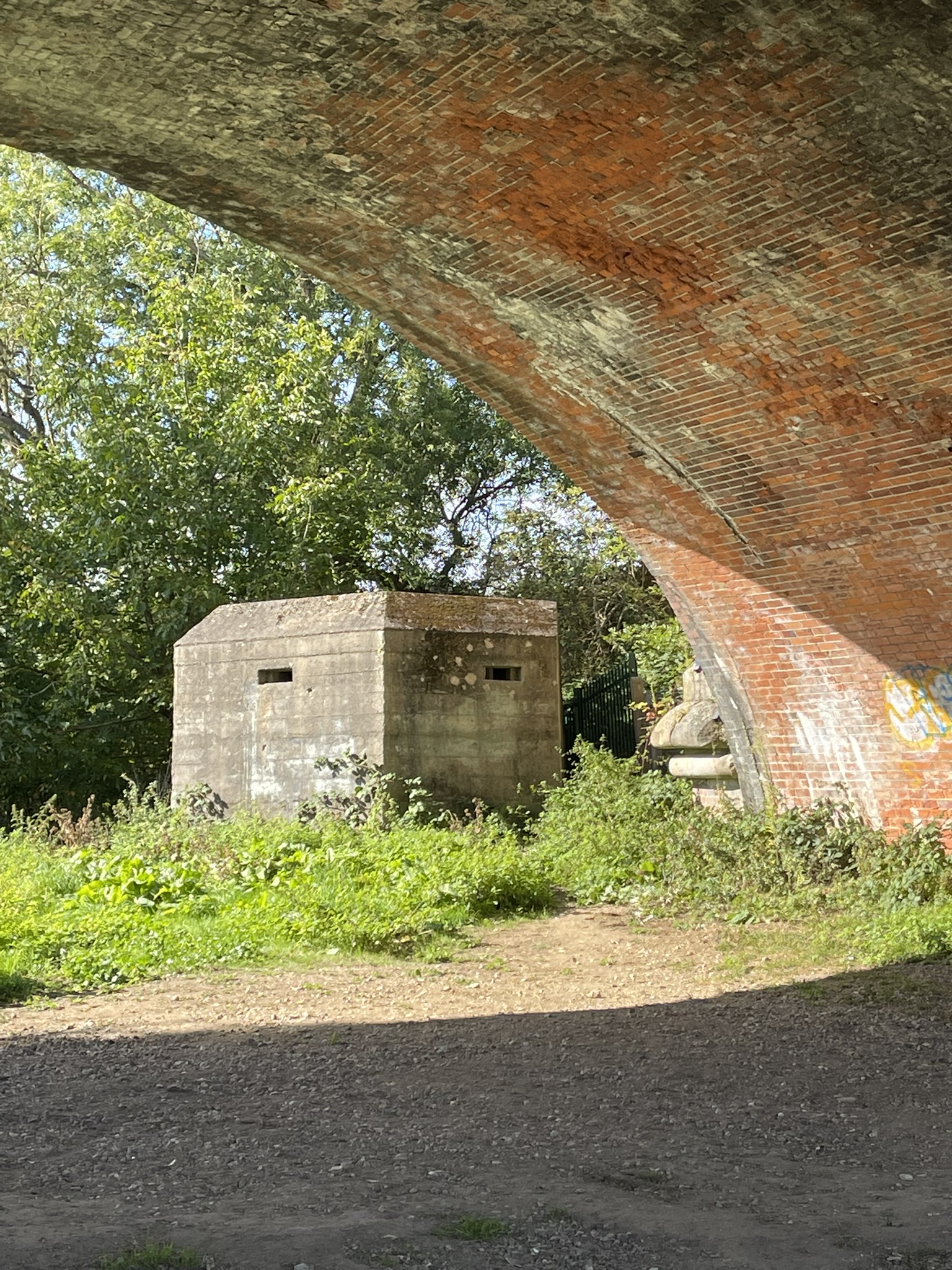
A moss-softened WWII pillbox peeked out from the bank—part of the hasty defence lines thrown up in 1940 when invasion felt a little too close for comfort. A significant number of these structures were integral to the nationwide GHQ Stop Line network, strategically positioned along the Thames, which served as a natural defensive barrier.
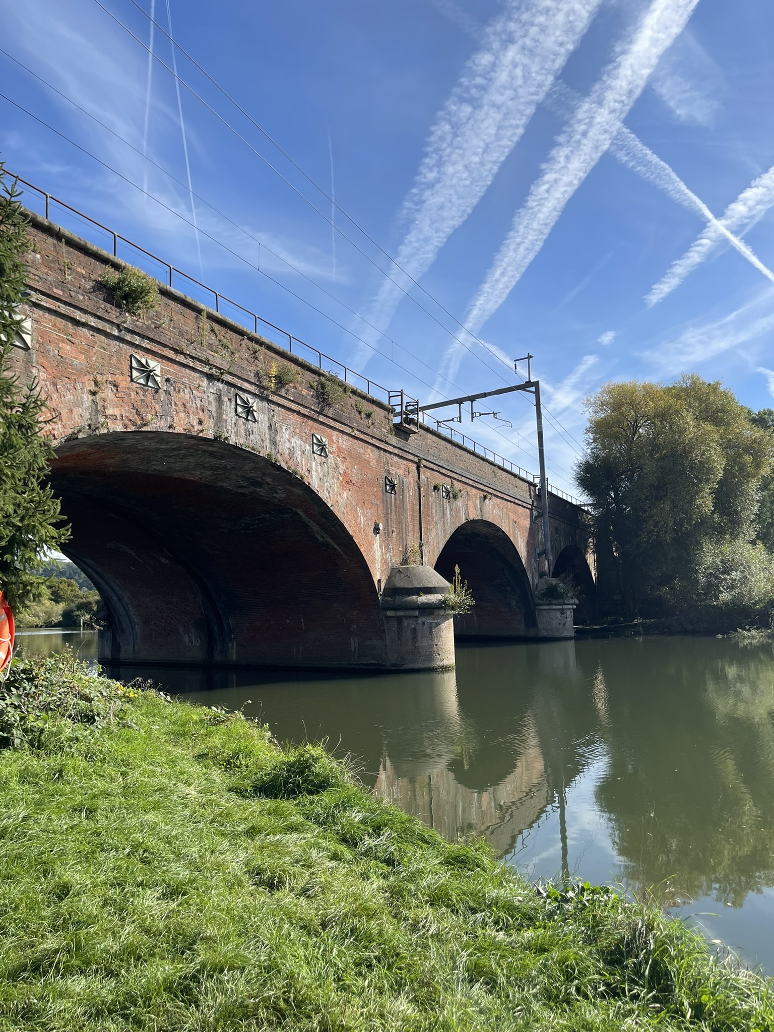
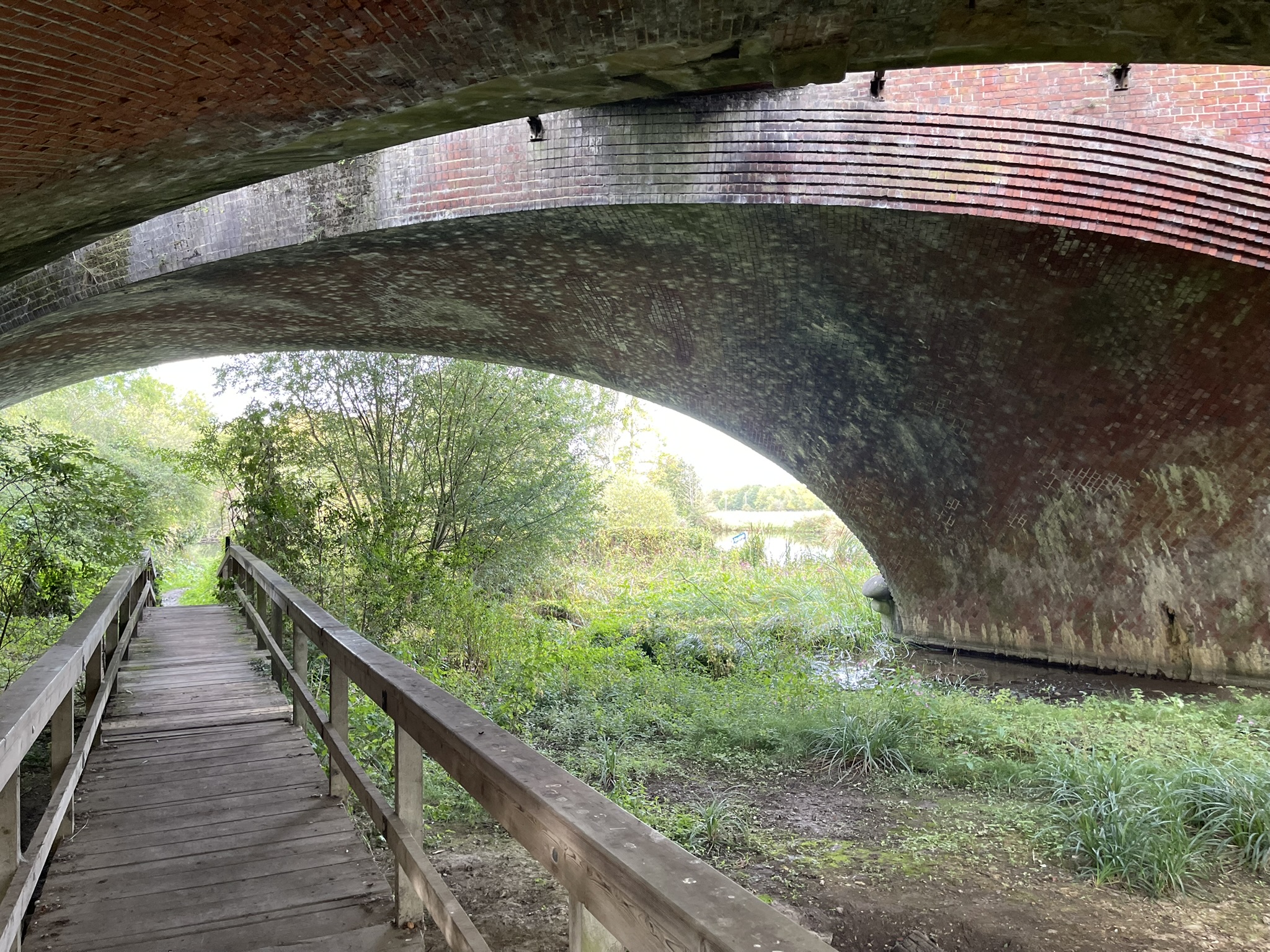
We continued along the path towards Goring and passed under Gatehampton Railway Bridge, which is part of the Great Western Main Line. The bridge is actually two individual viaducts. The first one, the west viaduct, was completed in 1840. But by the 1870s, demand was high for the train service, so a second viaduct was opened in 1893. The bridge was grade II listed in 1984. Just next to the bridge is another example of a WWII pill box.
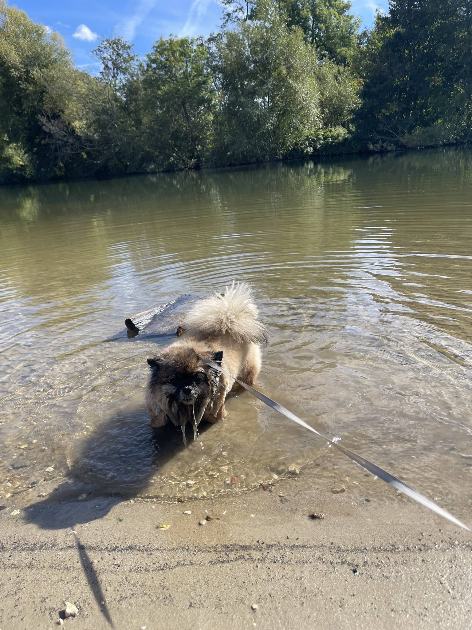
We rested for a while along the bank and had some lunch, and Cher took her promised plunge. She won’t be carried until she dries off! Luckily, the weather has stayed fine, and she soon dried off, and we were on our way again.
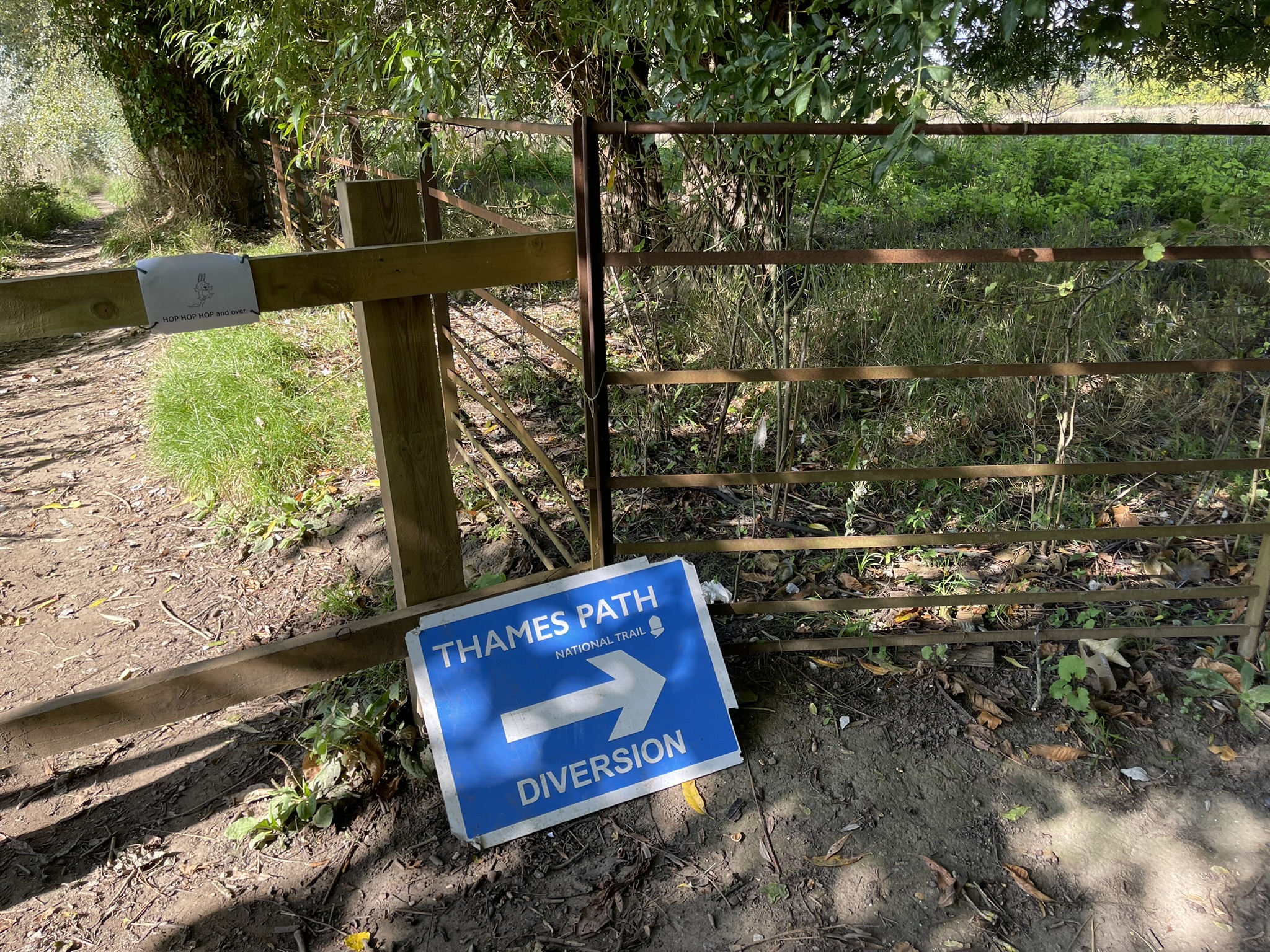
A small section of the path was closed off, and we had to follow a diversion for a short distance, so it wasn’t as bad as some of the diversions I’ve had to take along the path!
As we approach Goring, the River Thames carves its way through the chalk hills to form a tree-lined gorge between the Chiltern Hills and the North Wessex Downs, this is Goring Gap. The Gap creates a dramatic and beautiful valley between the villages of Goring and Streatley and is considered one of the most dramatic locations along the length of the river.
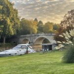
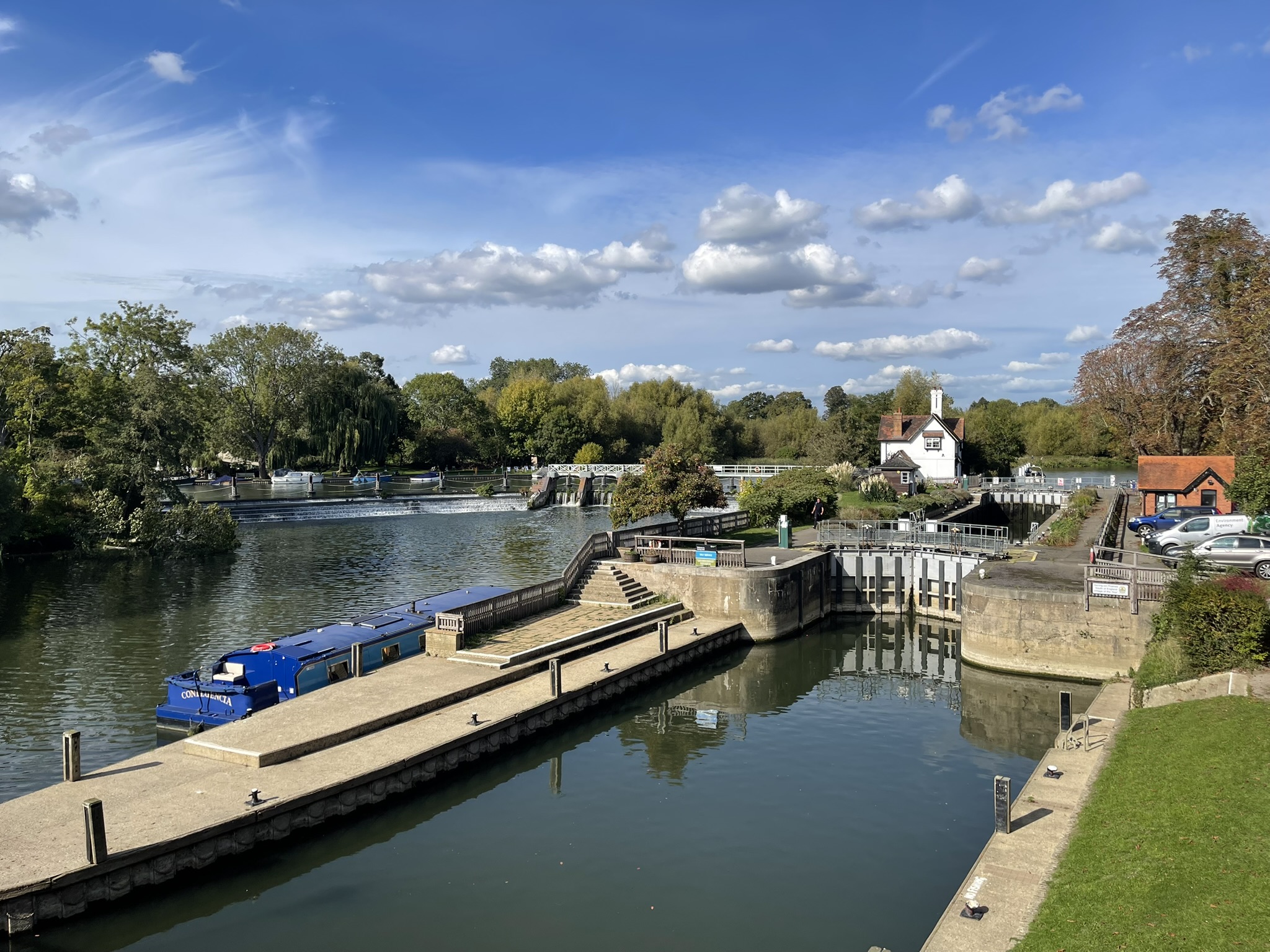
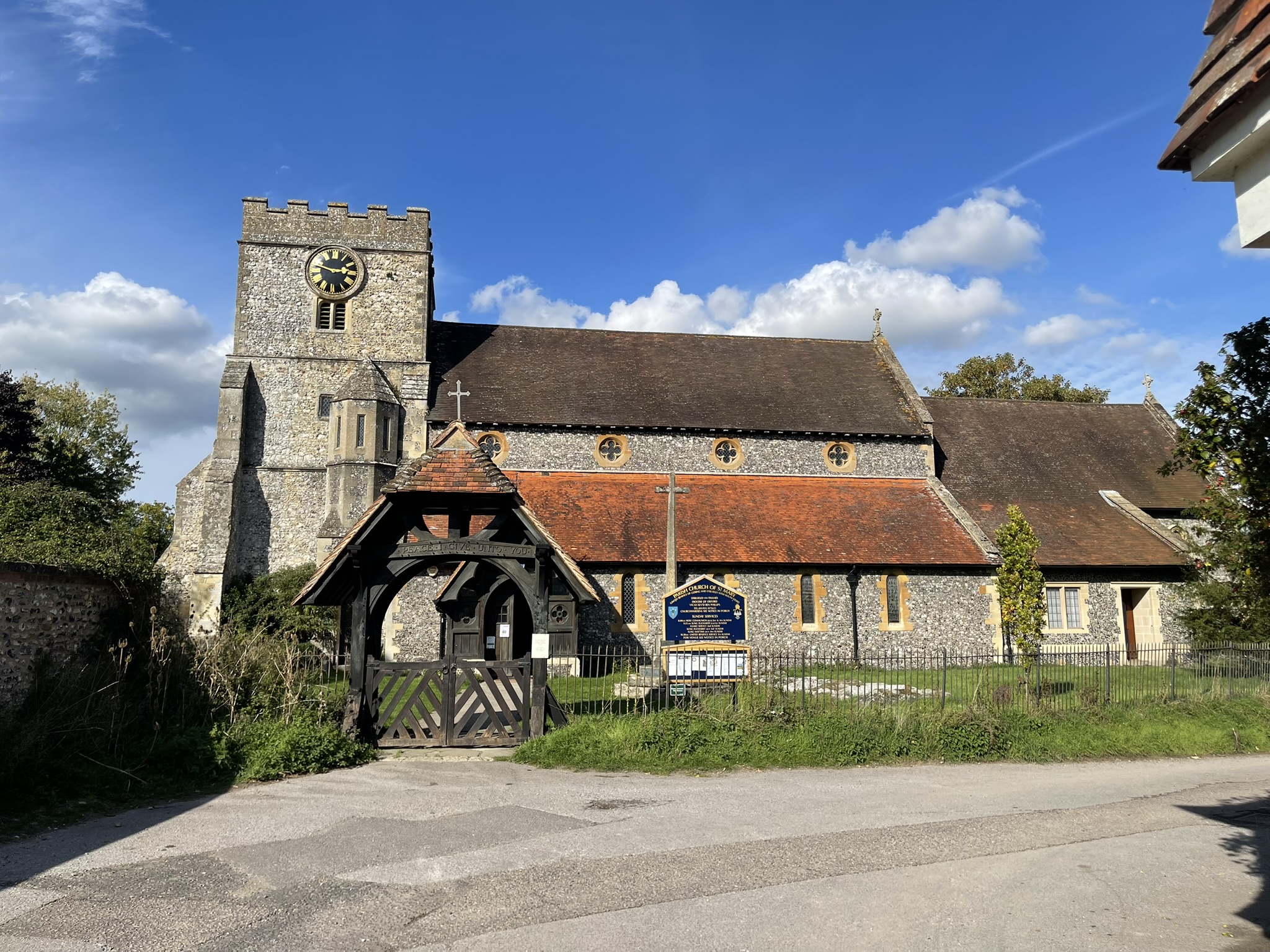
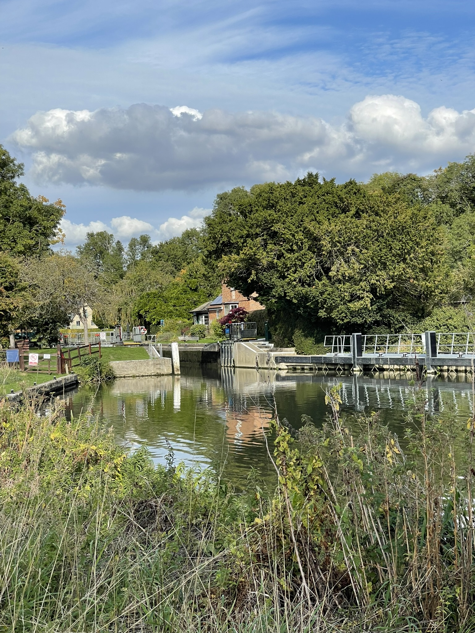
After crossing the bridge at Goring, which offers excellent views of Goring Lock (first built in 1787, replaced in 1886, and again in 1921), I initially took a wrong turn, ending up in a hotel car park. I backtracked to the main road and found the correct path, which led passed St Mary’s Church. This Grade II listed building dates from the 13th century, with the present church and chancel largely rebuilt in 1864. Notably, the English author and poet Lewis Carroll, also known as Reverend Dodgson, preached here in 1864.
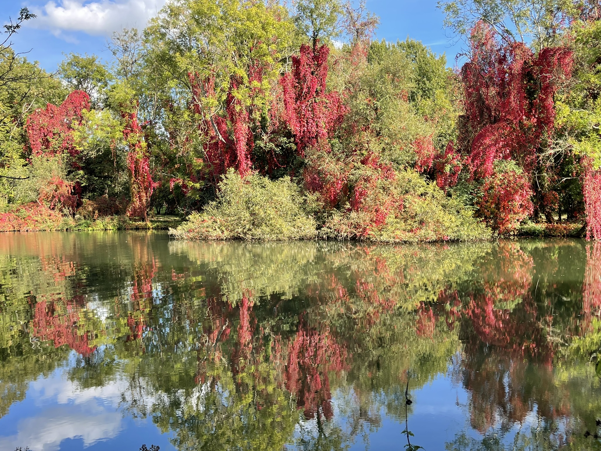
The path meandered back towards the river, where the water lay perfectly still, a mirror reflecting the vibrant autumnal hues of the surrounding trees. Ahead of us on the path were two pheasants who soon clumsily flew off when they saw us coming.
Soon we arrived at Cleeve Lock, notable for having the longest reach above it (6.5 miles) and the shortest below it (0.5 miles). A flash lock was first documented here in the 16th century. The name “Cleeve” originates from “cliff” or “clift,” referring to a water-cut channel. The weir was transformed into an oak pound lock in 1787, rebuilt with stone in 1874, and converted to hydraulic operation in 1966-67.
Further along the path we stopped off at The Beetle and Wedge pub to collect another stamp, and some refreshment. The unusual name of the pub refers to a beetle, a term for a maul (or hammer) used with a wedge to split wood. The pub is on the site of the former Moulsford ferry service and is listed amongst Britain’s 250 Best Restaurants.
This area of the river features not only in The Wind in the Willows, but it’s also where Jerome K. Jerome chronicled the escapades of his friends’ visits in Three Men in a Boat. We sat on the waterside terrace, basking in glorious sunshine, with a slight autumnal crispness. I could really stay here for the rest of the afternoon, but we had a few more miles to go yet, and, tempting as it was to have another pint and enjoy the weather, we moved on.
Beyond Moulsford Prep School’s playing fields, the path rejoined the river, leading us under the impressive Moulsford Railway Bridge. Also known as the “Four Arches” bridge, this structure actually consists of two bridges, both designed by Brunel, carrying the Great Western Main Line. The first was built between 1838 and 1840, and the second followed in 1892. What makes the bridge particularly remarkable is its brickwork, constructed at a skewed 60-degree angle.
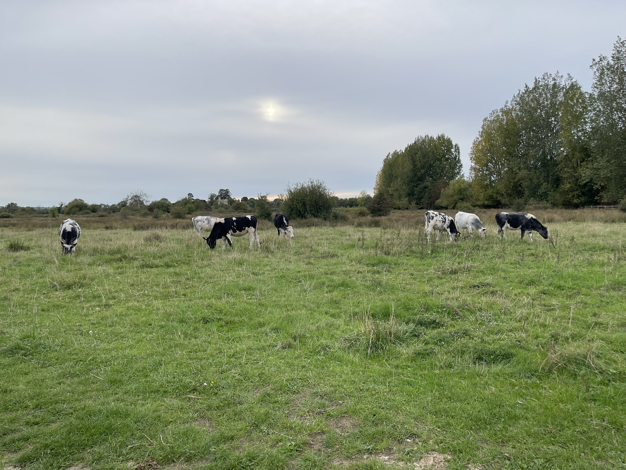
Here, the path narrowed and became quite muddy, much to Cher’s delight as she was safely in her carrier, avoiding mucky paws! We continued through a field of cows – a clear sign you’re truly in the countryside! We went under the unremarkable Nosworthy Mamun Bridge, carrying the A4130.
Entering Wallingford, we discovered a town steeped in English history. Its significance began in 1066 with the surrender of Stigand to William the Conqueror, an event that led to William’s ascension to the throne and the construction of Wallingford Castle. The town’s rich past is too extensive to fully detail here, but it’s worth noting that the Domesday Book of 1086 recognised Wallingford as one of only 18 towns in the kingdom with a population exceeding 2,000.
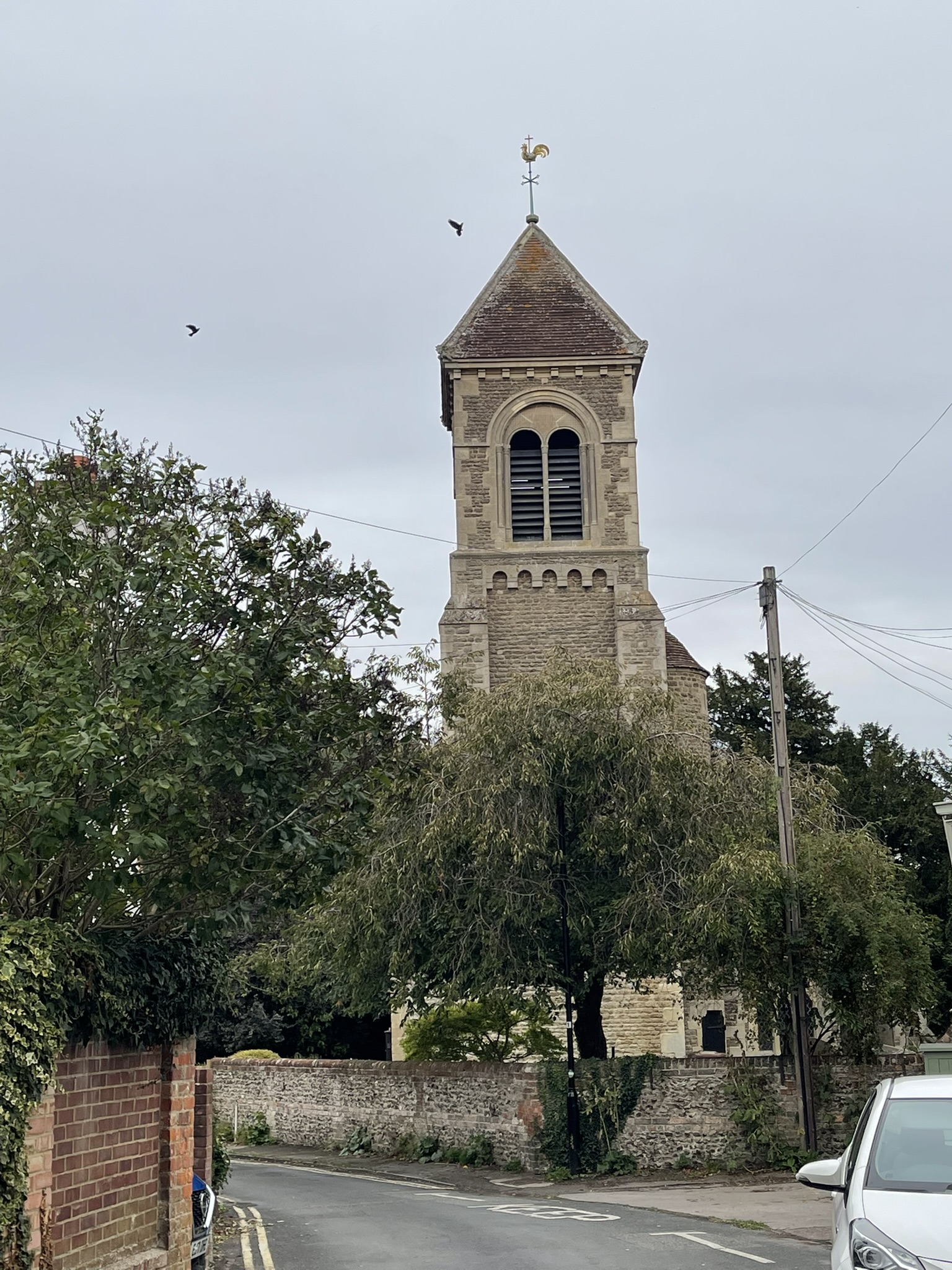
We then reached St. Leonard’s Church, Wallingford’s oldest church, believed to have Saxon origins. It was destroyed by the Danes in 1066 but rebuilt after the Norman Conquest. In 1646, Cromwell’s army used it as barracks, leaving it in ruins with the apse and south aisle completely demolished. The tower, largely dating from the 11th century, is the oldest part of the current structure. From 1849, the church was rebuilt in the Gothic Revival style under Henry Hakewill’s direction, preserving parts of the original Saxon building.
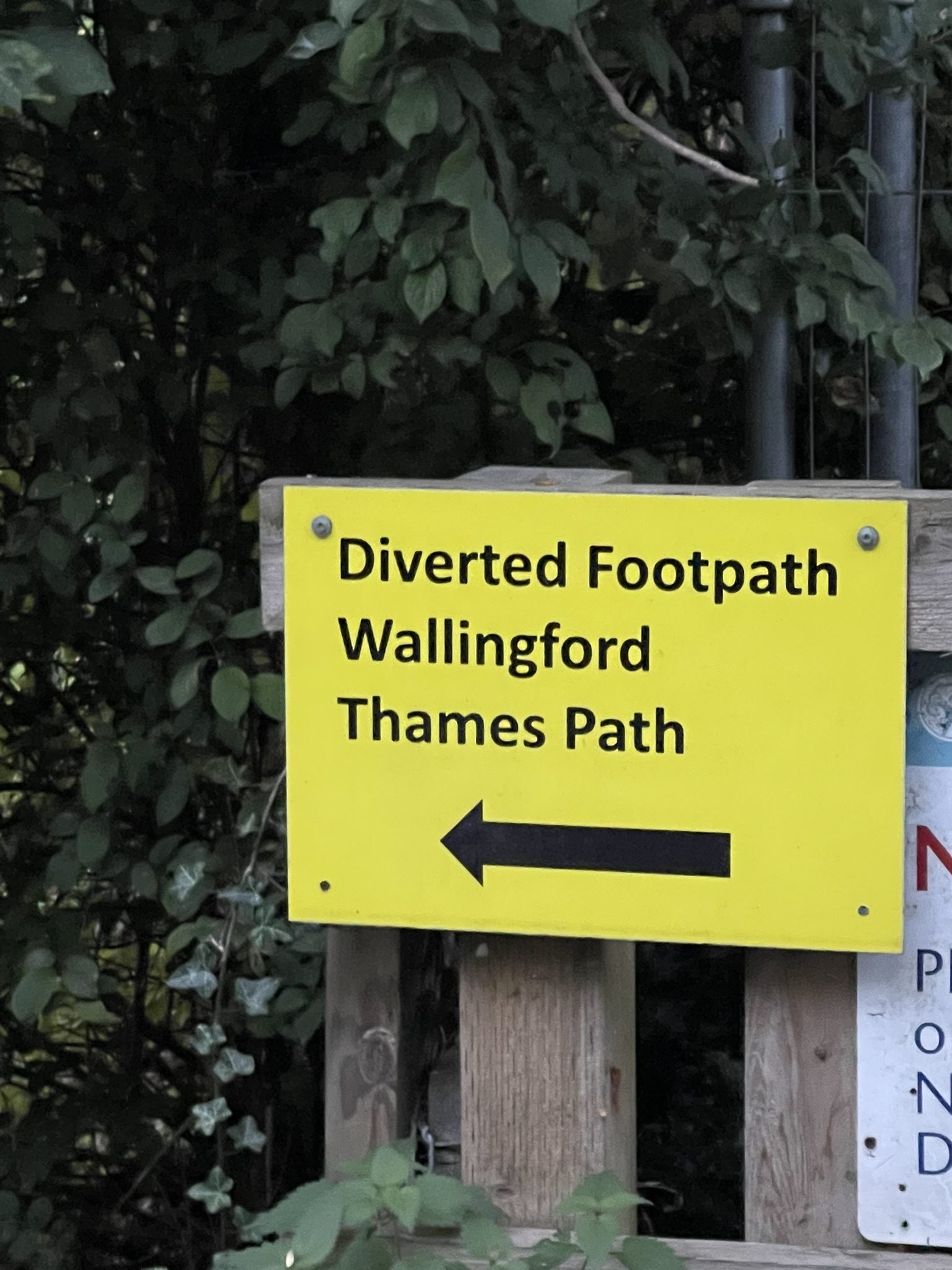
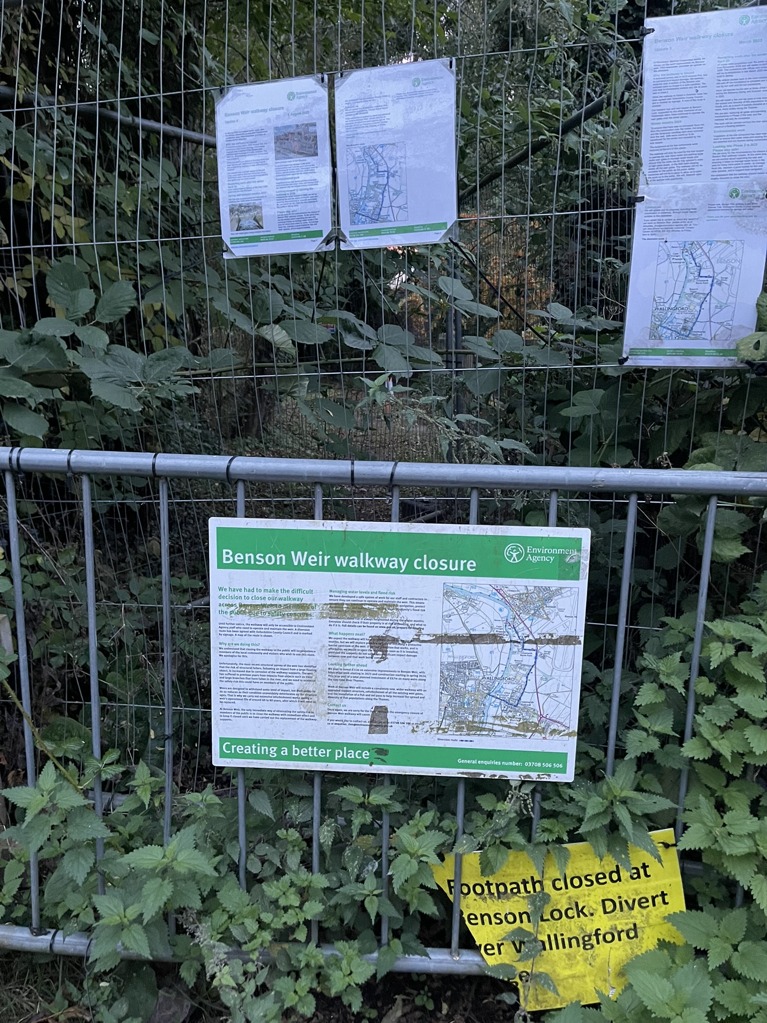
We then headed to The Town Arms pub, I hoped to get another stamp and a quick pint, but it was unexpectedly closed. Just as I was about to continue, a couple walking their dog stopped for a chat. They mentioned the path upstream was closed and advised crossing the bridge here, walking along the other side of the river until Shillingford. This was incredibly lucky; I was already tired, it was getting dark, and I would have wasted an extra mile or so.
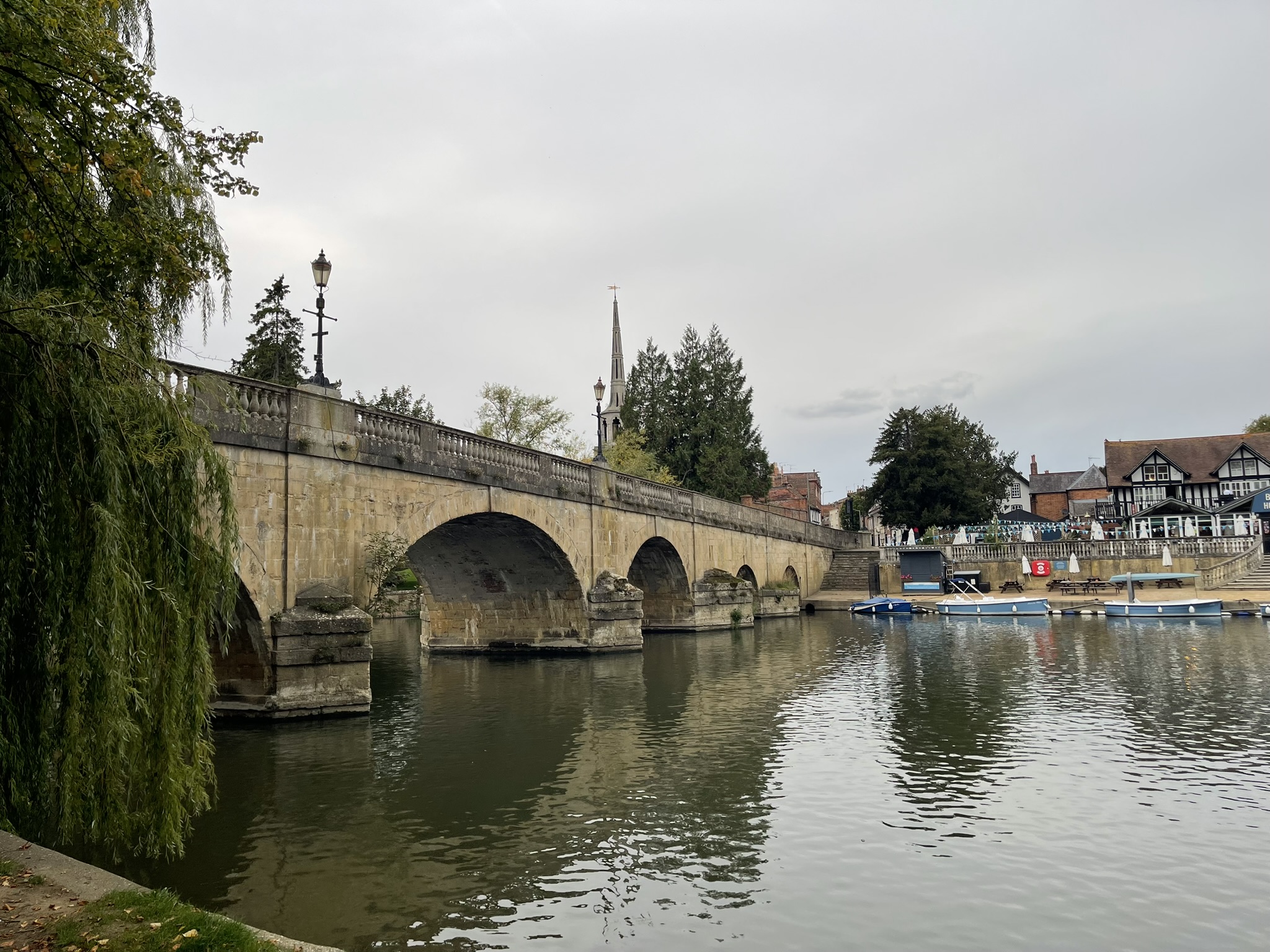
Following their advice, we crossed Wallingford Bridge. While I mapped out a route on Google Maps, we took a moment to sit down. The bridge’s history dates back to 1141. During the 1646 Civil War siege of the castle, four arches were removed to install a drawbridge. In 1671, wardens were stationed on the bridge to prevent people from Crowmarsh, who might carry the plague, from crossing. After a flood destroyed three arches, the bridge underwent a significant rebuilding in 1809, which included the addition of a balustrade and parapet.
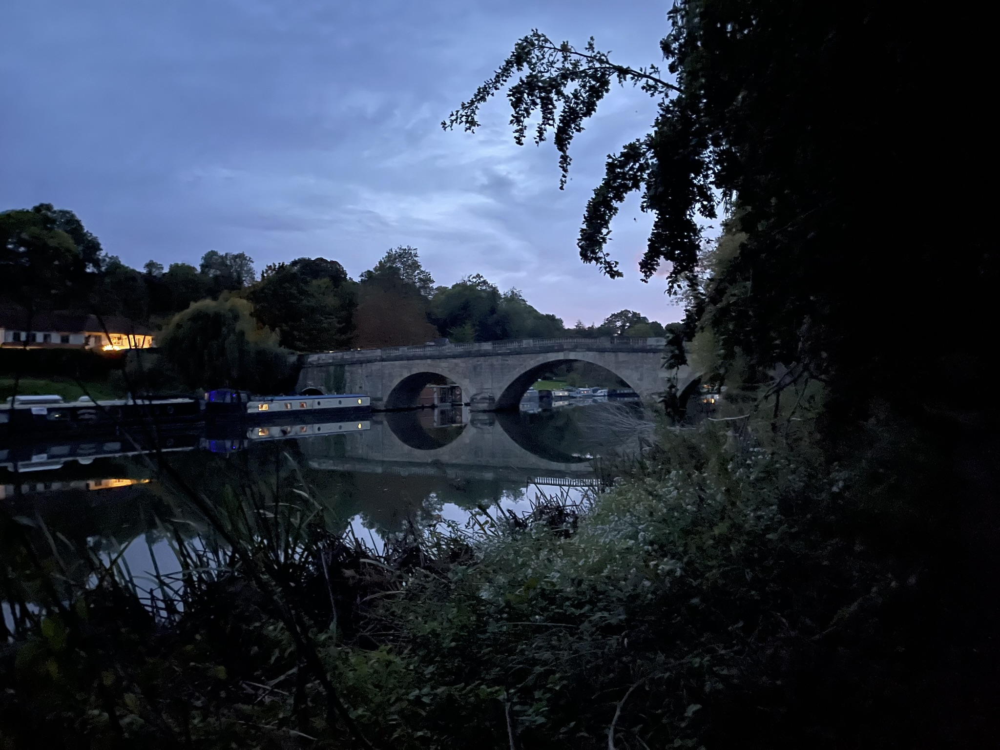
Restored after a break and with a clearer sense of direction, we resumed our journey towards Preston Crowmarsh, a small hamlet located a mile north of Wallingford. Our route took us to the outskirts of Benson before rejoining the path. As we entered a wooded area, the canopy of trees deepened the approaching twilight, urging us to quicken our pace (though Cher remained comfortably carried!). The fading light played tricks on my senses. I heard a splash in the river, an unseen creature – perhaps an otter – disturbing the water. Further on, shadows distorted into what I initially perceived as approaching figures, only to reveal themselves as mere trees. Finally, the sight of Shillingford bridge pierced the gloom, and the comforting view of my hotel, the Shillingford Bridge hotel, on the opposite bank brought immense relief.
After checking in, I was delighted to discover that my room had been upgraded. Despite booking a single room to save money, I received a suite, complete with a four-poster bed and a spacious bathroom overlooking the bridge. After enjoying an excellent steak in the restaurant, I unwound in a hot bath, feeling the warmth soothe every muscle. It had been a successful first day, with 16 miles covered and just 20 remaining to Oxford!